Customer
University of Texas, Scripps Institution of Oceanography, and GNS Science
Mission Location
East of North Island, New Zealand
Highlights
- Through a combination of instruments moored to the seafloor and high precision antennas on the Wave Glider, subtle plate movements can be detected
- Important horizontal movement data can now be collected both on land and in the ocean without being cost prohibitive
- Monitoring offshore tectonic plate boundaries helps to better understand the likelihood of large earthquakes and tsunamis
“Being able to use a Wave Glider to survey in the positions of seafloor acoustic arrays [...] is really helping to break open a new frontier in being able to monitor offshore tectonic plate boundaries and reveal the earthquake and tsunami hazard posed by them.”
Understanding Earthquake and Tsunami Risks for New Zealand
New Zealand sits astride a major boundary between the Pacific and Australian tectonic plates which are moving towards each other. Just to the east of the North Island, the Pacific Plate dives or “subducts” at a rate of 4 cm per year beneath the Australian plate at New Zealand’s largest and most dangerous plate boundary fault, the Hikurangi subduction zone.
Researchers from the University of Texas, Scripps Institution of Oceanography, and GNS Science (New Zealand’s geoscience research agency) are measuring the horizontal tectonic movement rate at the offshore Hikurangi subduction zone to identify whether the plates are locked up or sliding past each other. In a locked-up scenario, stress builds between the plates that may ultimately release in the form of large earthquakes and even tsunamis. This research is critical to better understanding the likelihood of earthquakes and tsunamis in the region, and to help inform community preparedness and planning for such events.
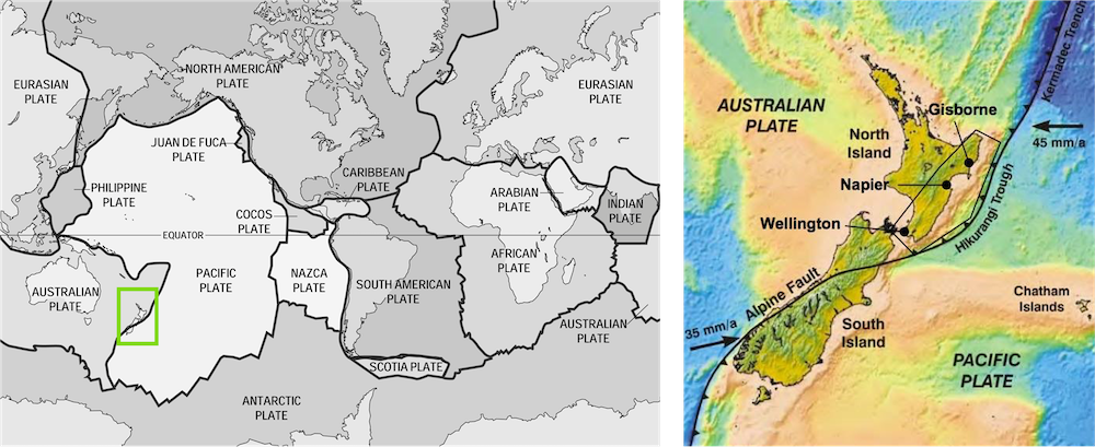
Left: Map of the world’s tectonic plates. Source: Wikimedia Commons. Right: New Zealand is located at the boundary of the Australian and Pacific tectonic plates. Source: Joides Resolution
Expanding Measurements to Offshore Areas
“We have been able to measure the horizontal movement of onshore regions to resolve plate locking and stress build-up on faults for decades with land-based GPS measurements, but until recently it has been technologically difficult and prohibitively expensive to make these measurements beneath the ocean”, said Dr. Laura Wallace, one of the Principal Investigators on the project and a Senior Research Scientist at the Institute for Geophysics, University of Texas.
High-precision instrumentation is necessary for this research since plate movements are extremely subtle and can be as little as one centimeter per year. Two Sonardyne Fetch Global Navigation Satellite System (GNSS) Acoustic Arrays, consisting of three responders each, were positioned on the ocean floor in 2018.
The first GNSS Acoustic array is located approximately 30 miles off the southern part of the North Island at a depth of 1.5 miles below the sea surface. In this area, land-based data suggests the tectonic plates are strongly locked together and building-up stress to be released in future earthquakes.
The second GNSS Acoustic array is located 70 miles offshore of the Hawkes Bay region of the central North Island, also approximately 1.5 miles deep. Here, land-based GPS data indicates the presence of “slow slip” events—a phenomena where the plates move very slowly past each other every year or two, creating slow-motion earthquakes that last days to months. These slow-motion earthquakes can slowly release energy equivalent to a Magnitude 7 earthquake without the shaking caused by “conventional” earthquakes, which release the same energy in a matter of seconds. Collecting offshore data will help reveal for the first time whether these land-based observations hold true for the offshore portion of the subduction plate boundary.
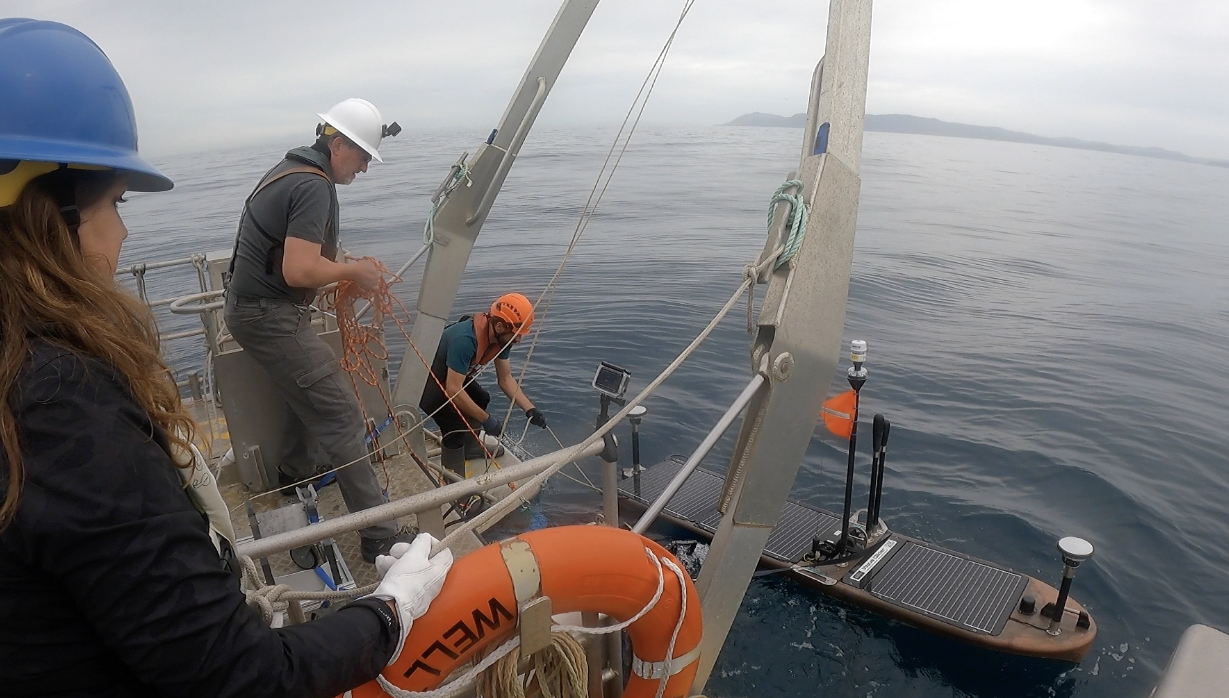
Equipped with high precision GNSS antennas at bow and stern, researchers deploy the Wave Glider in calm seas to the east of the North Island, New Zealand. Photo Credit: Zumberge Lab, IGPP, Scripps Institution of Oceanography
Connecting Researchers to Their Seafloor Data
To recover the data from the seabed arrays, a pilot navigates the Wave Glider to the array location through remote control. The pilots are able to track the Wave Glider’s position continuously using highly precise GNSS antennas located on the Wave Glider. Once on site, the Wave Glider issues acoustic commands to each bottom Fetch node. In reply, the bottom nodes acoustically transmit their data records to the Wave Glider for storage, processing, and communication. Together with the GNSS data being collected simultaneously by the Wave Glider, these acoustic data can be used to resolve the precise position of the Fetch array (within 1 cm). Repeated measurements of the array position can thus resolve the precise movement of the seabed and offshore tectonic plates. Since 2019, there have been four surveys of the New Zealand GNSS-Acoustic arrays using a Wave Glider.
The latest data retrieval in February 2023 suggests promising insights whether the offshore part of the Hikurangi subduction zone is locked up. “Being able to use a Wave Glider to survey in the positions of seafloor acoustic arrays to resolve changes in horizontal position of the acoustic arrays is really helping to break open a new frontier in being able to monitor offshore tectonic plate boundaries and reveal the earthquake and tsunami hazard posed by them”, said Dr. Wallace. The latest survey was undertaken with a new SV3 Wave Glider owned by Scripps Institution of Oceanography.
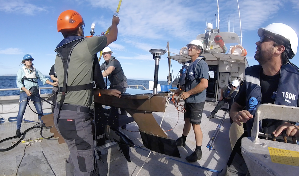
After successfully retrieving data from the Sonardyne Fetch GNSS acoustic arrays, researchers recover the Wave Glider. Photo Credit: Zumberge Lab, IGPP, Scripps Institution of Oceanography
Ongoing and Future Research
Similar research activities are underway at subduction zones in other parts of the world, such as the Cascadia subduction zone (in the Pacific Northwest), Alaska, and Japan. The Hikurangi project is jointly funded by the U.S. National Science Foundation and the New Zealand Ministry for Business Innovation and Employment. The acoustic arrays will be surveyed again in early 2024 and the goal is to leave the transponders in place to continue tracking these offshore plate movements for at least a few more years. Other research projects to detect seafloor movements and earthquakes at the Hikurangi subduction zone are also underway using seafloor pressure sensors and ocean bottom seismometers. Together these data are transforming the understanding of earthquake and tsunami hazard posed by the Hikurangi subduction zone to New Zealand.