Customer
NOAA Pacific Islands Fisheries Science Center
Mission Location
Main Hawaiian Islands
Highlights
- Wave Glider Winch enables data collection in depths of 20-150m through automated, location-based casts
- High-precision navigation skills allow Wave Gliders to collect data close to shore
- Wave Glider fleet provides comprehensive data set with spatial and depth gradients
“Our traditional approach to studying ocean ecosystems can be expensive, labor intensive, and has limited abilities to survey close to shore. Wave Gliders are cost effective with greater capacity to sample nearshore. And by using multiple vehicles, we are able to capture a more synoptic picture of ocean conditions around Hawaiʻi.”
Measuring Chlorophyll as an Indicator for Ecosystem Productivity
Scientists from NOAA’s Pacific Islands Fisheries Science Center (PIFSC) are studying the health of the ocean ecosystem in Hawaiʻi with the support of three Wave Gliders. The study includes 24/7 data collection on air temperature, wind, and barometric pressure on the surface; ocean waves, currents, water temperature and salinity just below the water surface; and most importantly, chlorophyll-a measurements between 20 m and 150 m depths using the Wave Glider Winch. The survey data will allow the team of researchers to make better predictions on how climate change will impact marine ecosystems and fisheries throughout the Main Hawaiian Islands in the coming decades.
“We are primarily interested in measuring chlorophyll, which provides a good estimate of phytoplankton biomass in the ocean,” said Dr. Jamison Gove, NOAA PIFSC oceanographer and co-lead scientist on the project. “Phytoplankton are the basis for productive and healthy ecosystems, so knowing where and how much phytoplankton there are in the ocean aids in understanding the entire marine food-web,” added Dr. Gove.
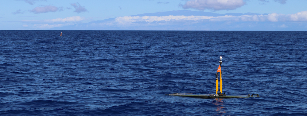
Three Wave Gliders are circumnavigating the Main Hawaiian Islands to collect chlorophyll-a data in depths of 20 m and 150 m.
Forming the critical base of the food chain, phytoplankton are microscopic plants that use chlorophyll to convert energy from the sun into food just like plants on land. In tropical regions such as Hawaiʻi, higher concentrations of phytoplankton lead to a more productive marine ecosystem, resulting in higher numbers of fish and overall ecosystem biomass. Lower levels of phytoplankton result in lower biomass.
“Climate change is increasing ocean temperatures and impacting the distribution and production of phytoplankton,” said Dr. Gove. “But how large scale changes will influence marine ecosystems here in Hawaiʻi is not well understood. This uncertainty is challenging for resource management and for local communities, especially where fisheries provide important food-resources and support economic livelihoods,” added Dr. Gove.
Water Profiles Provide Deeper Insights
The three Wave Gliders circumnavigate each of the Main Hawaiian Islands between 0.5 to 4 miles from shore, covering a total of over 3,000 miles. With their industry-leading ability to navigate precise courses in all weather conditions, the Wave Gliders are capturing data in close proximity to shore for this multi-month mission while transmitting real-time data to remotely located pilots and scientists. The ability to collect automated, location-based measurements to a depth of 150 m as often as desired is a novel capability for uncrewed surface vehicles (USV) and a game changing asset for researchers.
A survey of this scale would have historically used large ocean research vessels. “Our traditional approach to studying ocean ecosystems can be expensive, labor intensive, and has limited abilities to survey close to shore,” said Dr. Gove. “Wave Gliders are cost effective with greater capacity to sample nearshore. And by using multiple vehicles, we are able to capture a more synoptic picture of ocean conditions around Hawaiʻi,” added Dr. Gove.
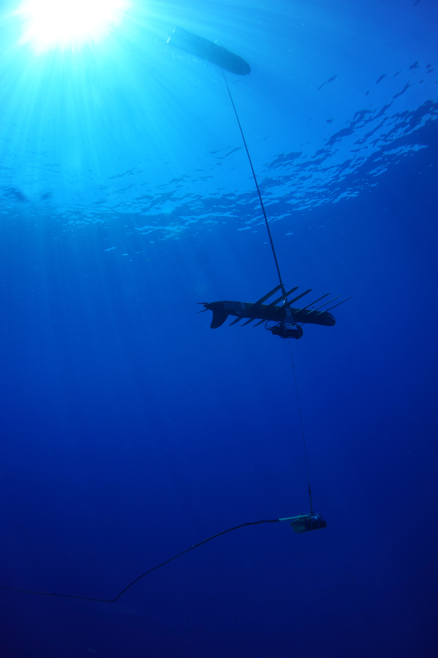
The fleet of Wave Gliders is equipped with winches to enable automated casts to a depth of 150 m.
Assessment Informs Ocean Conditions and Habitat of Whales and Dolphins
Data collected during the statewide Wave Glider survey coincides with NOAA’s Hawaiian Islands Cetacean and Ecosystem Assessment Survey (HICEAS). The ship-based HICEAS occurs once every eight years to assess the status and trends in whale and dolphin populations in Hawaiʻi.
“The autonomous Wave Glider survey is supporting a larger, multi-agency collaborative effort to assess the abundance and habitat of whales and dolphins across the Hawaiian archipelago. The Wave Gliders will provide really important data on ocean conditions and habitat near each of the islands, which are utilized by numerous species of whales and dolphins,” said Dr. Erin Oleson, marine biologist at PIFSC and lead scientist of HICEAS.
Collaboration and Funding Source
Liquid Robotics conducts the mission for NOAA PIFSC. The project is in collaboration with researchers from the University of Hawaiʻi at Mānoa Department of Oceanography and is supported by NOAA’s Office of Marine and Aviation Operations Uncrewed Systems Operations Center, which funded innovative partnerships in an effort to collect data for NOAA missions.