Customer
University of Washington, Scripps Institution of Oceanography
Mission Location
U.S. West Coast
Highlights
- A community of researchers is joining forces to collect and analyze seafloor movement data
- Acoustic communication between seafloor transponders and the Wave Glider allow for data “offloading”
- Survey costs are greatly reduced utilizing Wave Gliders instead of research vessels
“The Wave Glider approach greatly reduces the survey cost compared to collecting data with a research vessel and allows us to monitor the accumulation of elastic strain within the crust.”
Major Fault Poses Earthquake and Tsunami Risk
Stretching from Vancouver Island to California, the Cascadia Subduction Zone is a major fault that separates the Juan de Fuca and North America tectonic plates. The Juan de Fuca plate is slowly moving towards and diving beneath the continental North American plate. The Cascadia Subduction Zone—at the interface of these two tectonic plates—poses a risk for large earthquakes and tsunamis.
To develop more accurate forecasts of the earthquake and tsunami hazards, researchers from the University of Washington and Scripps Institution of Oceanography are assessing the relative movement between the two plates.
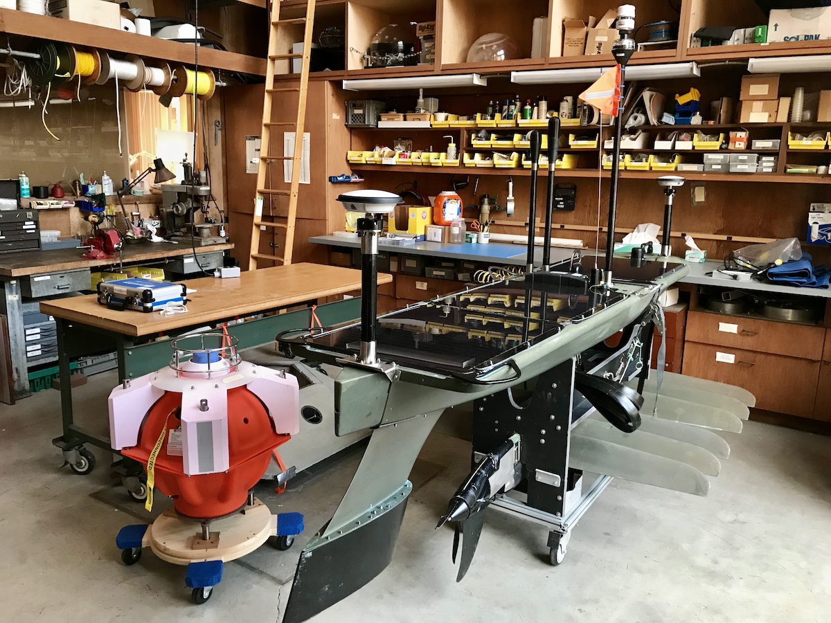
One of the Sonardyne Fetch transponders and the Wave Glider are syncing up at the Scripps laboratory before deployment. Photo credit: Glenn Sasagawa.
Enabling Regular Data Collection
Collecting measurements of seafloor movement in depths of 2000 m is a challenging and costly undertaking. At the edge of the continental shelf, approximately 60 miles offshore of Oregon, four survey sites had been established in previous years to gather initial data of plate movement.
Each seafloor site consists of a cluster of three Sonardyne Fetch transponders mounted on cement benchmarks that are resting on the ocean floor. A Wave Glider, equipped with a Global Navigation Satellite System (GNSS) antenna, is remotely navigated to each site, and sends an acoustic ping to each transponder, thereby determining the distance between the Wave Glider and each seafloor transponder. By marrying the acoustic range of the transponders with the GNSS position data of the Wave Glider, researchers are able to position the seafloor array within 1 cm precision. The sites are re-surveyed over multiple years, allowing for the tectonic movement of the plate to be assessed.
“Determining whether the seafloor in Cascadia moves at the subducting plate rate or is slowed because the fault is locked locally is important to our scientific understanding of the fault mechanics. The Wave Glider approach greatly reduces the survey cost compared to collecting data with a research vessel and allows us to monitor the accumulation of elastic strain within the crust”, said David Schmidt, Professor, University of Washington.
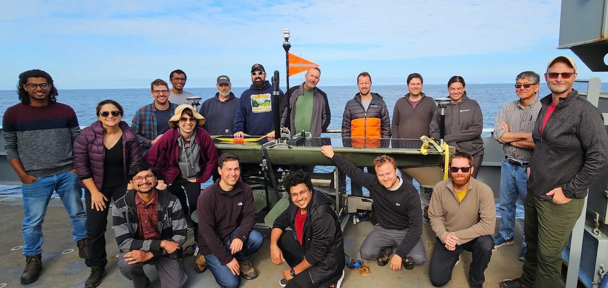
The GNSS acoustic surveys bring together a community of scientists from various institutions, continuously evolving data collection and data analysis methods to provide more accurate forecasts of earthquakes and tsunamis. Photo credit: Andrew Newman, www.seafloorgeodesy.org.
Collaboration across the Ring of Fire
This survey is part of a larger initiative that many institutions around the Pacific and globally participate in to gather critical plate movement data. Teams of scientists from the Georgia Institute of Technology, University of Kansas, University of Houston, and EarthScope Consortium are also actively investigating the Cascadia and Alaska Subduction Zone trenches. Researchers from the University of Texas, Scripps Institution of Oceanography, and GNS Science are conducting multi-year Wave Glider-supported studies in New Zealand.
“Gathering data at these different locations across the Pacific provides a wealth of information and enables us to better understand earthquake processes across Pacific shorelines. We are trying to collect in different regions to inform scientific studies and hazard assessments along the U.S. West Coast.”, said Glenn Sasagawa, Senior Engineer, Scripps Institution of Oceanography.
Beyond Data Collection
In addition to the in-water surveys, researchers are aiming to implement new algorithms to improve data processing and update forecasts of seismic hazards. The project also helps to train the next generation of students and young researchers in the use of seafloor geodetic techniques. Funding for this project is provided by the National Science Foundation.
Photo credit top banner: David Schmidt.