Customer
Orion Space Solutions
Mission Location
Pacific Ocean
Highlights
- Novel Ocean Stabilized Ionospheric Remote Imaging Sensor (OSIRIS) allows collection of space observations from the ocean surface
- OSIRIS integration onto Wave Glider Uncrewed Surface Vehicle provides mobile platform to collect images in remote ocean areas
- Increased amount of space weather data helps inform critical infrastructure on Earth
“Sitting atop this unique, autonomous platform, OSIRIS is the first-ever system to collect ionospheric data from the ocean’s surface. By developing OSIRIS’ capability to monitor the upper atmosphere, we will gain a better understanding of the dynamics and structure of the ionosphere at local, regional, and global scales.”
Space Observations from the Ocean Surface
Scientists at Orion Space Solutions have developed a revolutionary system that enables imaging of the Earth’s upper atmosphere ionosphere from the ocean surface to detect space weather impacts on Earth. The Ocean Stabilized Ionospheric Remote Imaging Sensor (OSIRIS) uses Orion’s advanced ionospheric sensing technology to collect space physics data from mobile and moored buoys and platforms, allowing scientists to make important observations in the challenging ocean environment. Orion recently launched OSIRIS in the Pacific Ocean on Liquid Robotics’ Wave Glider Uncrewed Surface Vehicle (USV).
“Sitting atop this unique, autonomous platform, OSIRIS is the first-ever system to collect ionospheric data from the ocean’s surface,” says Dr. John Noto, Orion’s Chief Scientist. “By developing OSIRIS’ capability to monitor the upper atmosphere, we will gain a better understanding of the dynamics and structure of the ionosphere at local, regional, and global scales.”
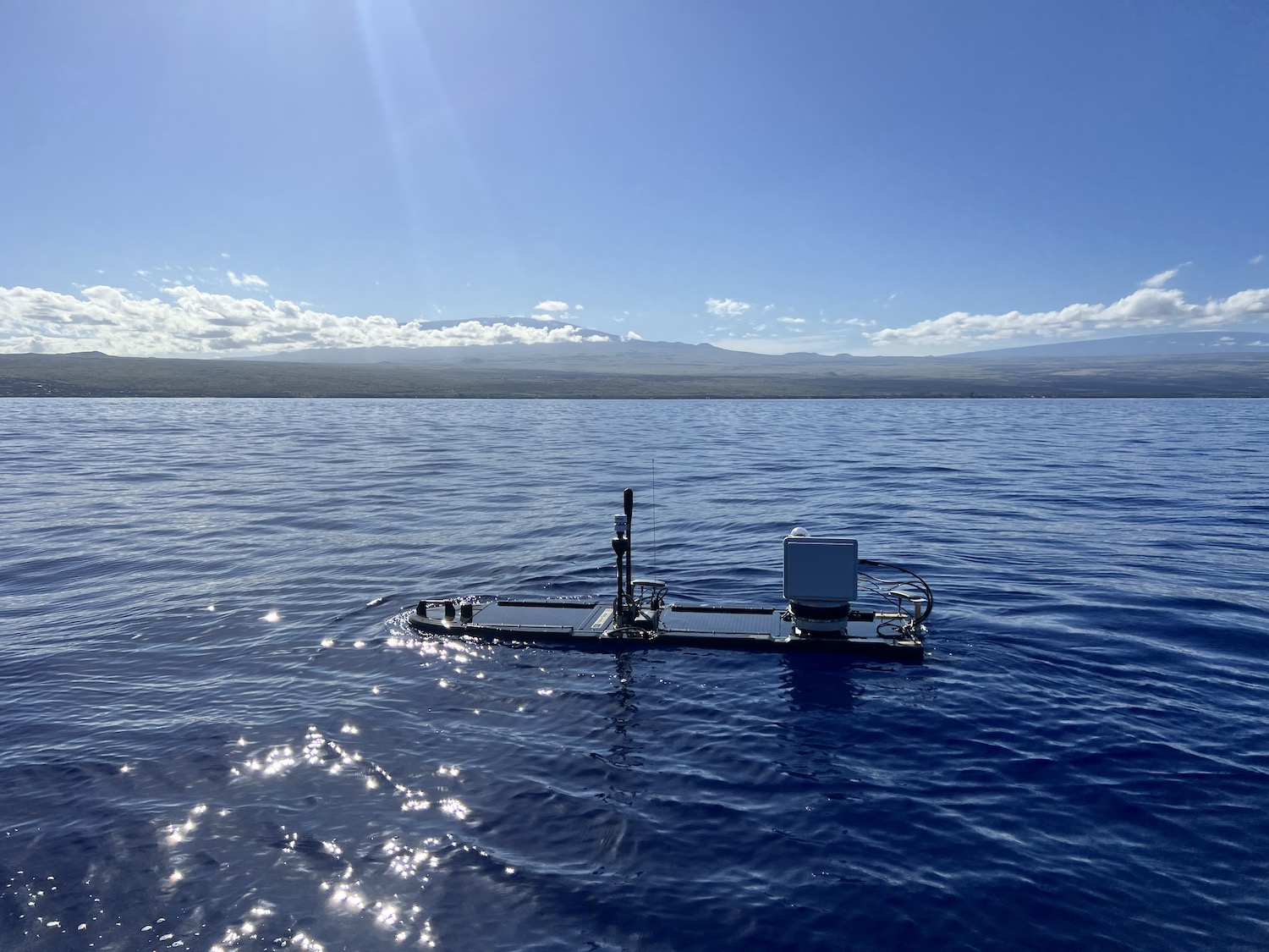
The OSIRIS payload is mounted to the surface float of the Wave Glider.
Relying on Autonomous Systems
Around the globe, land-based and buoy-based monitoring systems are used to assess space weather dynamics. Space weather affects Earth-based communications systems, power grids, and other crucial infrastructure. However, in regions such as the Pacific Ocean, few ionospheric sensors exist, making space weather forecasting and nowcasting challenging. Systems such as OSIRIS will fill these data gaps, providing a means of improving understanding of events that impact life on Earth.
Collecting scientific observations of space from the ocean surface is challenging due to the ocean’s dynamic and harsh environment and its vast extent. Like buoys deployed in the middle of the ocean, OSIRIS and its Wave Glider must withstand corrosion, extreme weather events, powerful currents, and surging waves.
“The Wave Glider is a robust and mature platform that scientists can rely on to test, advance, and implement new sensors. We are excited that Orion’s cutting-edge OSIRIS project leverages autonomous systems to collect space weather data from the most remote parts of our oceans,” says Shane Goodenough, CEO of Liquid Robotics.
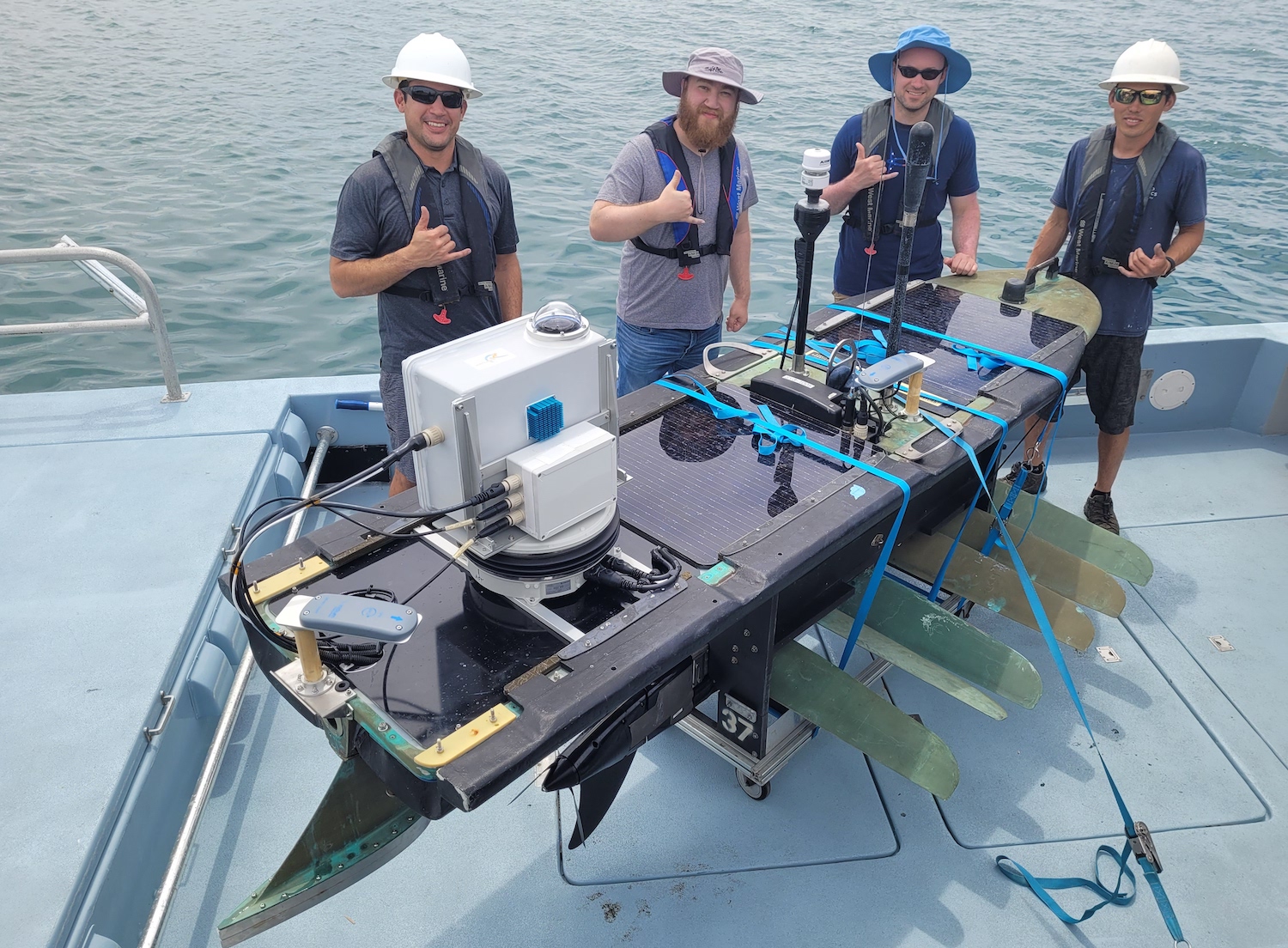
Team members from Orion Space Solutions and Liquid Robotics joined forces to integrate the payload onto the Wave Glider’s surface float and to successfully deploy OSIRIS.
Gimballed System to Ensure Sensor Stabilization
Despite initial and important advances made by Orion in previous years, there had not been sufficient progress in developing scientific instruments for collecting space physics data from the ocean surface. However, with OSIRIS, this has changed. The system allows imaging of common and “Earth-impacting” atmospheric phenomenon such as ionospheric plasma bubbles and traveling ionospheric disturbances (TIDs), increasing our understanding and ability to react to these effects, as well as opening up new research opportunities for the science community.
The OSIRIS system manages the ocean’s environmental challenges by using a 2- or 3-axis gimballed platform for sensor stabilization, compensating for the continuous motion of the Wave Glider caused by ocean waves. This enables the system to maintain pointing stability during the acquisition period, which can range from 15 seconds to 5 minutes.
The OSIRIS system uses all-sky imaging to capture the nightglow emissions, allowing imaging of ionospheric plasma bubbles and TIDs. This capability represents a transformative advancement in observational capability for studying the ionosphere and will open the way for new research activities in the field of heliophysics.
The Wave Glider harnesses wave energy for forward propulsion and collects solar energy to power onboard electronics and sensors. As it is entirely energy self-sufficient, the Wave Glider can stay on mission for more than 6 months at a time, providing real-time data and communications across a wide range of sea states and environmental conditions. The open and extensible architecture of the Wave Glider allows for custom integration of sensors and payloads, such as OSIRIS.