GEOMAR: Tracking Seafloor Motion with Wave Gliders
Liquid Robotics — September 6, 2017
Off the coast of northern Chile, where the Nazca plate meets the South American plate, scientists from GEOMAR Helmholtz Centre for Ocean Research Kiel have installed a network of sensors to measure and track seafloor motion. Their goal is to better understand earthquake and tsunami risk in an area where some of the most powerful earthquakes on the planet originate.
So, how is it possible to measure seafloor motion down to millimeter-scale accuracy through two miles of seawater? Let’s take a step back to appreciate the difficulty of this task.
On land, we can measure Earth’s movements with millimeter accuracy using a satellite-based GPS technique. But the radio signals that GPS relies on can’t pass through water. Enter seafloor geodesy, an emerging scientific field that uses newly developed marine technology and GPS-Acoustics to measure seafloor motion at millimeter-scale resolution.
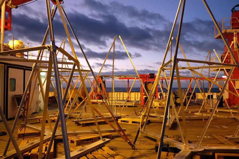
Photo by J. Steffen (GEOMAR)
The GeoSEA Earthquake Observatory
Back to the Nazca-South American plate boundary. There, GEOMAR scientists have installed a seafloor geodetic network called GeoSEA (Geodetic Earthquake Observatory on the SEAfloor) at depths ranging from 2600 to 6000 meters.
There are two key components to the network. The first resides on the seafloor, where autonomous monitoring transponders (AMTs) from Sonardyne are installed on 4m high tripods. Transponders within an array can communicate with one another via acoustic signals for a period of up to 3.5 years.
The second component is the Wave Glider, operating autonomously at the surface. It holds position above the seafloor sensors, monitors system health, uploads data from the seafloor nodes, and transfers it back to shore via satellite. This allows data to be collected more frequently, allowing the research vessel to focus on other more valuable tasks.
Dr. Heidrun Kopp, Chief Scientist at GEOMAR, said retrieving data with a Wave Glider was an important first step to proving out the capability of the network. “In the future, as we think about other seafloor geodesy projects in remote places, these would not be possible without the Wave Glider.”
Read our latest case study to learn more about the work GEOMAR is doing.
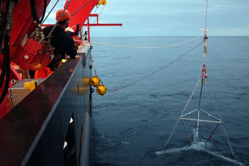
Photo by J. Steffen (GEOMAR)
Collaboration Across the Globe
Additional seafloor geodesy projects are underway across the globe, all in pursuit of scientific advances that will help us crack the code on earthquake and tsunami risk. Dr. David Chadwell of Scripps Institute of Oceanography is working with the National Science Foundation (NSF) and the United States Geological Survey (USGS) to better understand the Cascadia Subduction Zone, off the coast of the Pacific Northwest. Scientists from Earth Observatory of Singapore are studying the Mentawai Gap near Indonesia. A collaboration between Mexico and Japan is focused on the seismic gap off the coast of Guerrero, Mexico. In each, Wave Gliders offer the ability to collect the data in real-time, which would be prohibitively expensive with boats.
For a scientific field still in its infancy, collaboration is key. “We’re in close communication with each other so we all know what each other is doing. The workload at the moment is so huge—it’s really a brand-new field—and I think we’re doing it in a pretty connected fashion,” said Dr. Kopp.
Future of Unmanned Systems in Seafloor Geodesy
We asked Dr. Kopp what she sees for the future of seafloor geodesy:
“In the long run, the next evolutionary step of seafloor geodesy would be to have a connection with the onshore geodetic network. This will require a benchmark at the sea surface. There are two possible ways of doing this: you could take a vessel out and leave it there for three or four days, but for most parts of the world this is just simply not feasible because it’s just too expensive to have a research vessel just sitting on top of seafloor stations.
This is where the Wave Gliders come in. I’m very confident that within a few years we will be looking around the globe at many seafloor geodetic networks, and there will be a fleet of Wave Gliders acting as the surface node of that network. And then it’s much more than just a transmitter, because then it’s included into the measuring scheme of the network itself. At that point, we can make a real breakthrough in global seismology and that is exciting.”
With millions of people in potential impact zones around the world, we couldn’t agree more.
Learn more about the work Dr. Kopp and other scientists at GEOMAR are doing in our latest case study.
