Grant-Funded Research with Wave Gliders
Liquid Robotics — May 8, 2017
Imagine you can send a computer server out into the ocean for up to a year to collect and analyze whatever data you wanted? What would you do with it?
That’s the question that has been inspiring researchers to do creative work with Wave Gliders for years.
Since the first National Science Foundation (NSF) grant that included funding for a Wave Glider back in 2010, researchers have received grants for Wave Gliders to sample chlorophyll blooms, monitor marine life, explore polar seas, and more.
Early successful grants served to establish the credibility of the Wave Glider as a platform for collecting ocean data. Researchers needed to validate that they could get the same quality data from the Wave Glider as they could from a buoy or a boat, and that the platform could survive the rigors of the open ocean.
Once it was established that the Wave Glider could collect reliable data, then it could get to work. Here are a few examples of grant-funded work that inspires us. In each, the Wave Glider offers a way to get data over longer durations or in rougher seas than previously possible.
- The First Grant
- Proving the Platform
- Real-Time Seismic Telemetry
- Further Progress on Earthquakes and Tsunamis
- Coastal & Fisheries Research
- Honey Badger Do Care
- Next Stop: Antarctica
- Wave Gliders for Researchers Program
- Resources
The First Grant
Dr. Charles Greene of Cornell University was the first recipient of a Wave Glider-related grant to better understand fish populations. He sees the potential for unmanned surface vehicles to not only reduce the cost of ocean data collection but to expand the spatial and temporal coverage of surveys.
From the grant abstract:
“The wave glider seems like an innovative platform for an echo-sounder because it stays on the surface, has continuous satellite GPS and data telemetry, and the potential for solar charging. An echo-sounding capability on such a platform would be a significant advancement for biological/fisheries research and management. Imagine the benefit of augmenting or even replacing expensive ship operations that currently run echo-sounder transects for fisheries surveys with a fleet of cost efficient gliders that could provide better spatial and temporal coverage.”
Greene subsequently published A Wave Glider Approach to Fisheries Acoustics: Transforming How We Monitor the Nation’s Commercial Fisheries in the 21st Century in Oceanography.
Animation courtesy A Wave Glider Approach to Fisheries Acoustics: Transforming How We Monitor the Nation’s Commercial Fisheries in the 21st Century
Proving the Platform
Before the Wave Glider could be used as a platform for subsea acoustic communications, its capabilities had to be tested under a range of conditions. Brian Bingham led a team of researchers from the University of Hawaii and the Woods Hole Oceanographic Institution (WHOI) in a series of experiments.
From the published research:
- Quantify the acoustic signature of the wave glider
- Evaluate the performance of the wave glider as a platform for passive acoustic monitoring
- Demonstrate active acoustic ranging and evaluate the potential of the wave glider as an acoustic navigation gateway to support underwater localization
- Test the ability of a modified wave glider to precisely localize seafloor instrumentation
- Demonstrate acoustic communication between the glider and seafloor instrumentation”
“We describe the results of experiments and analysis to quantify the performance of this new platform for acoustic applications. The goals of this work are as follows:
The results of these experiments (spoiler alert: they are good!) are detailed in Passive and active acoustics using an autonomous wave glider, published in the Journal of Field Robotics. After publishing this article, Bingham successfully received an NSF grant to further study how Wave Gliders and other ocean robots could be used to detect and monitor oil plumes.
Real-Time Seismic Telemetry
While Bingham and team tested the acoustic applications, over at Scripps Institute of Oceanography, Dr. Jonathan Berger and team set out to create a real-time seismic observatory.
From the abstract:
“We describe a new technology that can provide near real-time telemetry of sensor data from the ocean bottom without a moored buoy or a cable to shore. The breakthrough technology that makes this system possible is an autonomous surface vehicle called a Wave Glider developed by Liquid Robotics, Inc. of Sunnyvale, CA, which harvests wave and solar energy for motive and electrical power. We present results from several deployments of a prototype system that demonstrate the feasibility of this concept. We also demonstrated that a wave glider could tow a suitably designed ocean bottom package with acceptable loss of speed. With further development such a system could be deployed autonomously and provide real-time telemetry of data from seafloor sensors.”
Full details are available in the research article, An ocean bottom seismic observatory with near real-time telemetry.
Image courtesy Scripps Institution of Oceanography
Further Progress on Earthquakes and Tsunamis
Yes, still at Scripps—what can we say, they have excellent taste in unmanned surface vehicles that can help them collect the ocean data they need!
Building on the seismic telemetry research from the prior example, Dr. David Chadwell of Scripps Institute of Oceanography is working on measuring the elastic strain buildup in subduction zones, to better understand potential earthquake and tsunami risk.
From the grant abstract:
“Great subduction zone earthquakes offshore Japan, Chile, and earlier Sumatra caused extensive damage due the earthquake itself and the resulting tsunami. A similar type of subduction zone fault lies offshore the Pacific Northwest, the Cascadia Subduction Zone (CSZ). It last ruptured in 1700 long before the extensive establishment of populated communities. Since then the CSZ has been building up elastic strain in the crust at the rate of a few centimeters per year. In the future, this stored elastic energy will likely be released as a powerful earthquake and tsunami. Much of the elastic strain is accumulating the seafloor offshore the coast. By measuring the slow buildup of this strain offshore, a better understanding of the potential earthquake and tsunami risk can be established. By combining the Global Positioning System and an acoustic ranging system on a sea surface platform, and acoustic transponders on the sea floor, the elastic strain buildup can be measured. Small (surfboard-size) wave- and solar-powered platforms can now replace large ships for much data collection. However, this requires re-engineering the onboard electronic components to be smaller and lower power, which is the goal of this project.”
This research is still in progress, results should be published later this year.
Fun fact: Dr. Chadwell’s original grant included a diesel-powered buoy. However, after he realized the advantages that the Wave Glider’s mobility and longevity could offer, he successfully petitioned to use a Wave Glider instead.
Coastal & Fisheries Research
Did we mention you get to name your Wave Glider? One of our favorites has to be Blackbeard, at East Carolina University.
Dr. Joseph Luczkovich and team are using Blackbeard to record the soundscape of the ocean, identify areas where there is a lot of biological diversity, and ultimately help protect and conserve threatened species.
Honey Badger Do Care
Tenacity. That’s the thinking behind why The University of Texas Marine Science Institute named their Wave Glider “Honey Badger.” It was going to take persistence to sample chlorophyll blooms in remote parts of the open ocean.
About the mission:
“The mission of the Honey Badger is to sample the late summer chlorophyll bloom that develops near 30°N, with the goal of using the camera and LISST-Holo to try to identify species in the blooms and then follow the development of phytoplankton aggregates. These aggregates have recently been shown to be a significant part of the total amount of carbon that sinks to the deep sea.”
Prior to this mission, Dr. Tracy Villareal and his collaborator Dr. Cara Wilson of NOAA/SWFSC won the Liquid Robotics PacX Challenge, a competition designed to encourage innovative applications of the PacX ocean data. The grand prize of a $50,000 research grant (courtesy of BP) and six months of Wave Glider time was then combined with an NSF award to make the Honey Badger mission possible.
Their winning research compared scientific spatial data collected from U.S. satellite streams to in-situ or surface data collected by the four PacX Wave Gliders, with a focus on large phytoplankton species. Read more in the published article, A Comparison of the Pac-X Trans-Pacific Wave Glider Data and Satellite Data (MODIS, Aquarius, TRMM and VIIRS).
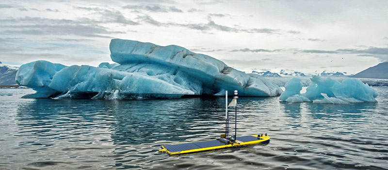
Next Stop: Antarctica
For many recently-funded projects, Wave Gliders are still out there collecting data. Here are two we are particularly excited about, both looking to demonstrate how autonomous platforms can fill observational gaps in the Southern Ocean near Antarctica, with the goal of improving climate models.
Dr. James Girton and Dr. James Thomson of the University of Washington
From the grant abstract:
“The coupled air-sea dynamics of the Southern Ocean play a critical role in the ocean’s transport and storage of heat and carbon dioxide and the response of these processes to climate change. This project advances our capability to observe air-sea dynamics under winds through a 6-month deployment of a wave glider. The wave glider has been adequately demonstrated as a robust high-endurance platform for open-ocean work and has begun to demonstrate its capability for research-quality measurements. This project will advance that capability by increasing our understanding of vehicle and sensor performance and suitability for measuring air-sea fluxes of momentum, moisture, and heat. Simultaneously, the vehicle will be used to study critical scientific questions on air-sea interactions. The main research topics addressed in this project are the spatial structure of winds and surface properties in the Southern Ocean, the influence of surface wave Stokes drift on Ekman transport in the upper ocean, wave modulation of wind stress, near-inertial wind energy input into the ocean, and the coupling between winds and sea surface temperature.”
A joint effort between researchers from Woods Hole Oceanographic Institute and Scripps Institute of Oceanography
From the grant abstract:
“The Southern Ocean is responsible for about half the uptake of anthropogenic carbon and an even larger fraction of the atmosphere’s flux of heat into the sea. The Southern Ocean is the only sector of the global ocean that connects all three major ocean basins through the Meridional Overturning Circulation (MOC). Despite its importance, the region is under sampled largely due to its remote location and severe conditions. The dearth of observations in the Southern Ocean is not limited to ocean measurements. Meteorological measurements such as wind speed and heat fluxes are scarce and often from sensors mounted on sparse ship traffic. With the maturing of autonomous platforms, there is now an opportunity to collect high-resolution spatial and temporal measurements in the full range of conditions characteristic of the Southern Ocean.”
Wave Gliders for Researchers Program
Liquid Robotics was founded by researchers who wanted to find a reliable and persistent way to monitor humpback whales. Ever since, ocean research has been part of our DNA. To continue our commitment to the research community, we offer an open platform for sensor integration, access to a robust community of users, and discounted pricing on Wave Gliders to non-profit research institutions and universities through the Wave Gliders for Researchers Program.
Can a Wave Glider help you with your research?
If you are thinking about requesting a Wave Glider as part of an upcoming grant proposal, we’re here to help answer any questions.
Resources:
